Skip to content
Preview
Members Only Science Complete Lesson Pack Grade 2
No ratings yet

Mountains, Valleys and Islands: Exploring Landforms

About This Resource

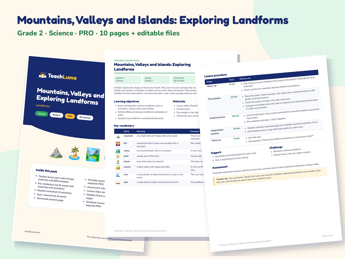
A complete Grade 2 science lesson pack on landforms and bodies of water: mountains, hills, valleys, plains, islands, canyons, rivers, lakes and oceans, how they are different, reading a simple map and making a landform model. Includes a lesson plan, worksheet, quiz, homework, A5 flashcards, a rubric, detailed slides with speaker notes, Word files and answer keys.

Overview

Children explore the shapes of the land on Earth. They learn to name and describe mountains, hills, valleys, plains, islands and canyons, and bodies of water such as rivers, lakes and oceans. They compare a mountain and a hill, match landforms to their descriptions, sort land and water, read a short passage about an island and plan a landform model.

Resource Details

Subject
Science
Topic
Landforms
Category
Earth & Space
File Type
PDF
File Size
387 KB
Published
31 Oct 2026
Downloads
0

Members Only

Upgrade to Teacher Pro (from ฿199/month) to download this resource.

Share:

Looking for something different? Request a Resource.

Grade 2 (ages 7–8) 50 minutes Earth science vocabulary comparing reading modeling

Learning Objectives

  • Name and describe common landforms such as mountains, valleys, plains and islands.
  • Tell the difference between landforms and bodies of water.
  • Compare two landforms using describing words.

How to Use This Resource

  • Show the slides and look at photos of each landform together.
  • Use the flashcards to teach the words, then complete the worksheet.
  • Use the quiz to check learning and send the model homework home; answers are in the answer keys.

Classroom Activity Ideas

  • Landform hands: children use their hands to show a mountain (pointed fingers), a valley (cupped hands) and a plain (flat hand).
  • Play dough landforms: children build a mountain, a valley and an island on a paper plate and add blue paper for water.
  • Map hunt: on a simple map, children find and color a river, a lake and a mountain.

Differentiation

Support: focus on five landforms with photos and hand actions. Challenge: research a famous landform and explain how it was formed.

Assessment

The worksheet and quiz check landform names and descriptions (answer keys included). Use the rubric for the comparison and the model.

Teacher Tips

Use real photos, ideally from your own country. Children understand landforms much better when they can connect them to places they have visited or seen.

What's Included

  • 10-page printable PDF lesson pack: teacher lesson plan with timings, materials and differentiation
  • Key vocabulary list (8 words with meanings and examples)
  • Student worksheet (5 activities)
  • Quiz / assessment (3 parts)
  • Homework practice page
  • Printable flashcards: 8 A5 picture cards (separate PDF)
  • Assessment rubric (4 levels)
  • Lesson slides (editable PowerPoint)
  • Editable Word version of all student pages
  • Complete answer key (also as a separate PDF)

Additional Files

  • Lesson Slides (PowerPoint, editable) (PPTX)
  • Editable Student Pages + Lesson Plan (Word) (DOCX)
  • Flashcards (PDF, A5, one card per page) (PDF)
  • Answer Key (PDF) (PDF)

Teacher Reviews

No ratings yet

Be the first teacher to review this resource.

Sign in to review this resource.

Related Resources

Advertisement